
Every Way Into the Water
All 23 public beach accesses in Oak Bay—mapped and explained, with swim and launch ratings, tide and water-quality checks, Google Maps links, and a phone-sized field map.
By Oak Bay Local ·
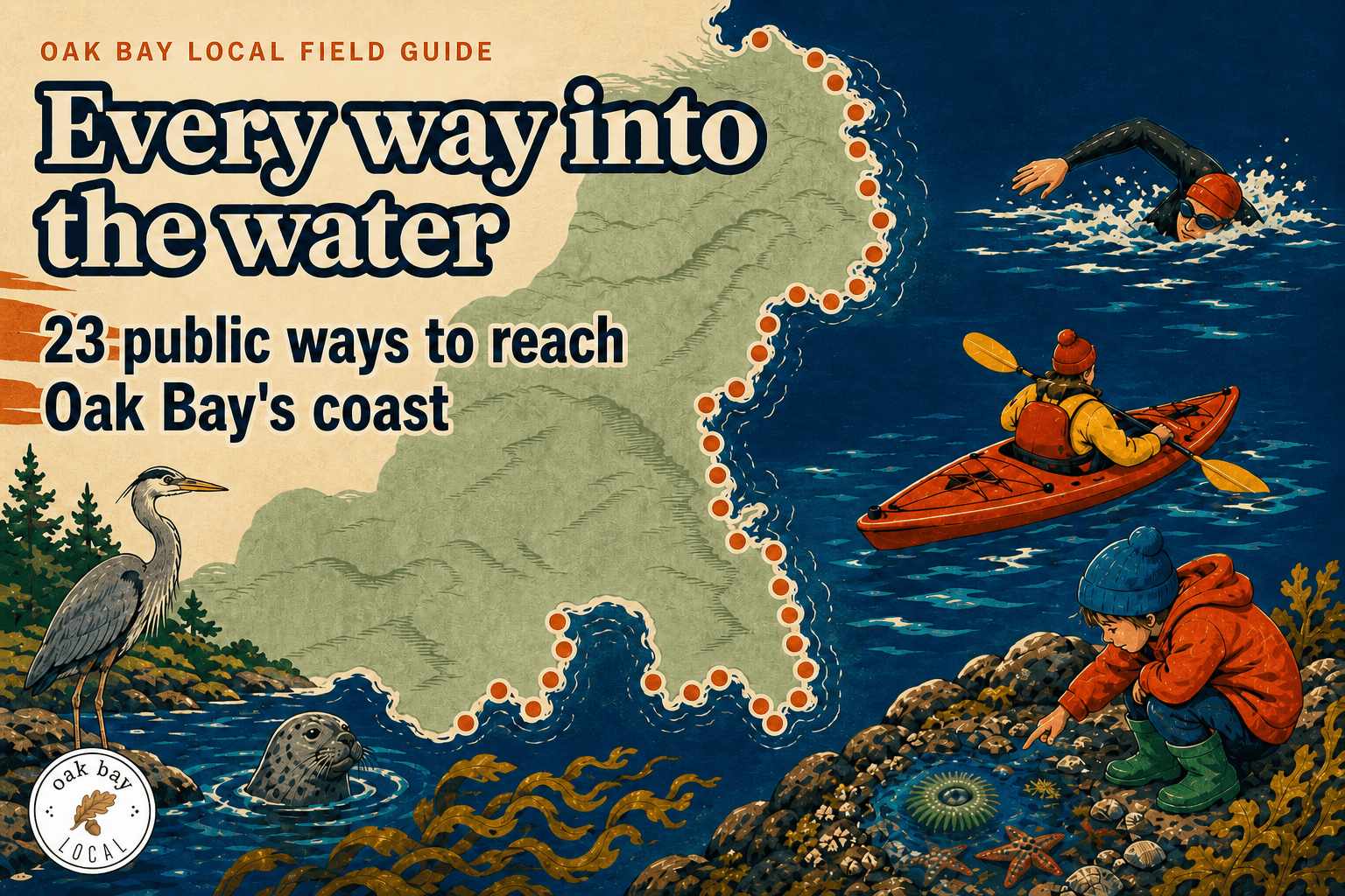
One of the best ways to get to know Oak Bay is to follow the roads until they run out.
Do that often enough and you find 23 public ways down to nearly 18 kilometres of coastline. Some end at sand. Others end at rock, rough stairs, or a place to lower a kayak. A few seem made for nothing more ambitious than standing still and looking at the water.
Summer gets most of the beach attention. Fall may be the better time to learn the shoreline. The light sits lower, the wind has more to say, and the differences between one bay and the next are harder to miss.
We checked all 23 accesses against the District's route ratings, swim and launch recommendations, current water information, and tide tools. Start with the kind of fall afternoon you want. Then follow the map to the water.
Save the map to your phone. All 23 public accesses, north to south, in one field map. Download the Oak Bay beach access map
Before you head out: route ratings describe general access, not today's surf, water quality, tide, or stair conditions. Check the live links below and follow posted signs.
Where to go
For the familiar sandy beach, head to the Estevan, Dalhousie, or Bowker Avenue entrances at Willows Beach.
For a kayak or canoe launch, the District recommends Cattle Point and the Estevan and Dalhousie entrances at Willows. Several other routes are marked manageable, but not recommended.
For swimming, the District recommends ten access points: Hibbins Close; the three main Willows entrances; Turkey Head; Radcliff Lane; McNeill Bay; Lorne Terrace; Marne Street; and Foul Bay Road.
For tide pools, shoreline rock, birds, and open views, start at Cattle Point. The District recommends it for launching a boat, but not for swimming.
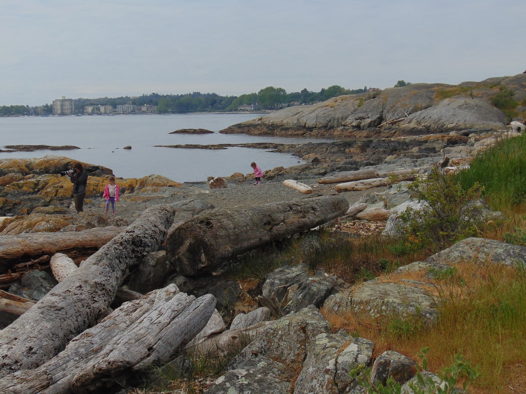
Cattle Point is a recommended launch, but not an official swim pick. Photo: Anne Delong / Wikimedia Commons, CC BY-SA 4.0
Check the tide and water quality
Oak Bay's coast has a reliable party trick: the beach you visited at noon may be mostly gone by dinner. Low tide can reveal rock, eelgrass, and long reaches of beach. A rising tide can remove the route you used on the way out.
Water quality changes too. Willows is sampled at the foot of Estevan and at the south end. Swim Guide posts the latest available result and explains the sampling schedule. Always follow signs at the beach, even if an app says the water is safe.
An Oak Bay Local survey respondent asked for regular water-safety reporting. Because conditions change, the current sample matters more than a standing recommendation. The latest result is linked below.
Cold water is another risk. Health Canada warns that sudden exposure to water at 15°C or below can cause gasping, cold shock, and a rapid loss of swimming ability. A calm bay can still be dangerous. New cold-water swimmers should stay close to shore, go with someone, use proper thermal protection, and make themselves visible.
The District ratings in this guide describe general suitability. They are not live safety guarantees. Shorelines move, stairs close, and storm work happens. Follow posted signs at the access.
- Check today's Oak Bay tide — Canadian Hydrographic Service station 07130
- Check the latest Willows water result — Swim Guide monitoring information
Stay in the know with shoreline updates Beach closures, water-quality notices and new Oak Bay field guides, sent every Saturday morning. Join the Saturday email
North Oak Bay
North Oak Bay is where the map starts to feel like a small treasure hunt. Six road ends reach the water before Beach Drive arrives at Cattle Point. Read the rating before trusting the distance: a short route can be difficult, and an easy route can end at water the District does not recommend for swimming.
Hibbins Close
When Willows feels like a group project.
Distance: 58 m · Route: Moderate · Swim: Recommended · Launch: Not recommended · Amenities: Toilets and picnic tables
The District recommends Hibbins for swimming, but not for launching a kayak or canoe. It is the quiet alternative when Willows has started to resemble a group project.
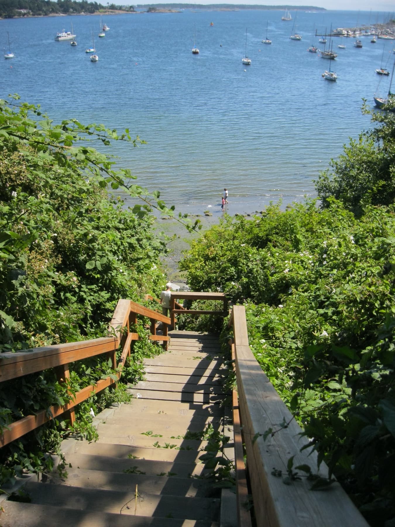
The route at Hibbins Close. Photo: John Newcomb / Wikimedia Commons, CC BY 3.0
Exeter Road
Easy down. Better for a paddle than a swim.
Distance: 34 m · Route: Easy · Swim: Not recommended · Launch: Manageable
The walk down is rated easy. The District does not recommend swimming here. Easy access and good swimming are two different columns for a reason.
Humber Road
Seven metres from road to shore, and easy to miss.
Distance: 7 m · Route: Moderate · Swim: Not recommended · Launch: Manageable
At seven metres, this is the shortest named route in the District table. It is shorter than many driveways and much easier to miss.
Lansdowne Road at Beach Drive
A long way down for a look, not a dip.
Distance: 93 m · Route: Moderate · Swim: Not recommended · Launch: Not recommended
Come here for a shoreline walk or the view. The District does not recommend launching or swimming here.
Rutland Road
A tree-framed lookout with a shoreline attached.
Distance: 35 m · Route: Moderate · Swim: Not recommended · Launch: Not recommended
The narrow, tree-framed route opens onto the rock and water, but the official table gives it no green light for getting wet. Treat it as a small lookout with a shoreline attached.
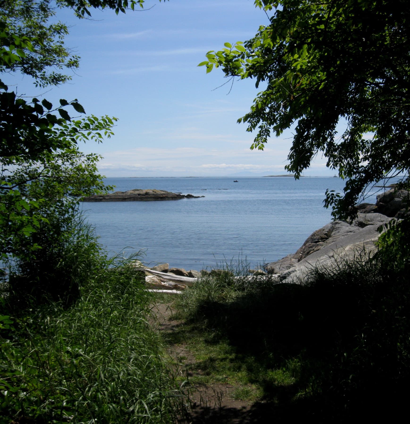
Rutland Road access. Photo: John Newcomb / Wikimedia Commons, CC BY 3.0
Surrey Road
The launch is possible. Remember the carry back.
Distance: 80 m · Route: Moderate · Swim: Not recommended · Launch: Manageable
A hand launch is possible on paper, but not ideal. Think about the full carry, including the turn back up after time on the water, before unloading anything awkward.
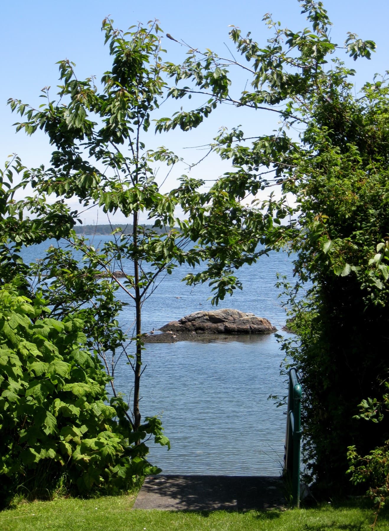
Surrey Road access. Photo: John Newcomb / Wikimedia Commons, CC BY 3.0
Cattle Point
For paddles, tide pools and low autumn light.
Distance: 125 m · Route: Easy · Swim: Not recommended · Launch: Recommended · Amenities: Toilets and picnic tables
Cattle Point works well for paddling, tide pools, birdwatching, or sitting by the water. The District does not recommend it for swimming.
The rocks and open views make it a strong fall destination. The light gets lower, the summer crowd thins, and the shoreline still has plenty to do. Cattle Point is also part of the Victoria Harbour Migratory Bird Sanctuary. Give the birds, marine life, and intertidal zone more room than the person taking a panoramic photo beside you.
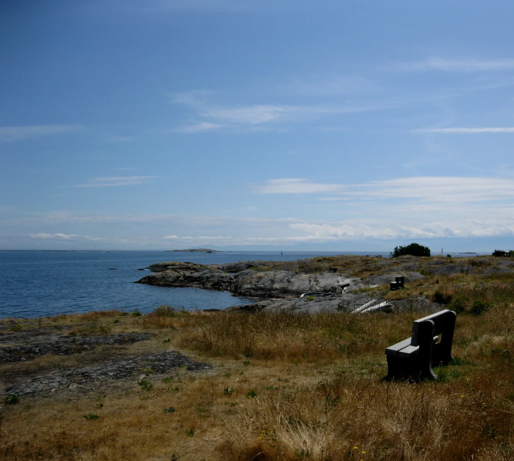
Cattle Point. You don’t have to get in the water to enjoy this one. Photo: John Newcomb / Wikimedia Commons, CC BY 3.0
Willows Beach
Willows is not one access point in the District table. It is four. The best entrance depends on what you are carrying, who is with you, and whether getting into the water is the whole plan.
Estevan Avenue
For swimmers, paddlers, coffee and sand in the car.
Distance: 100 m · Route: Easy · Swim: Recommended · Launch: Recommended · Amenities: Toilets and picnic tables
Estevan works for almost everyone: swimmers, paddlers, coffee drinkers, and the child who has already decided some sand is coming home in the car.
Dalhousie Street
Same beach. A better entrance when you are carrying a boat.
Distance: 115 m · Route: Easy · Swim: Recommended · Launch: Recommended · Amenities: Toilets and picnic tables
Dalhousie offers a straightforward route for swimmers and hand-carried boats. It gives groups another way down without crowding the Estevan entrance.

Evening at Willows Beach. Photo: Alanarce / Wikimedia Commons, CC BY-SA 4.0
Bowker Avenue
Bring a swimsuit. Leave the kayak elsewhere.
Distance: 120 m · Route: Easy · Swim: Recommended · Launch: Not recommended · Amenities: Toilets and picnic tables
Head to Bowker when swimming is the plan. Carry boats through Estevan or Dalhousie instead.
Bowker Lane
Willows' longest route and its odd one out.
Distance: 195 m · Route: Easy · Swim: Not recommended · Launch: Not recommended · Amenities: Toilets and picnic tables
The longest route in the official table is still rated easy. It is not the entrance the District recommends for putting yourself or a boat into the water, which makes it the odd one out in the Willows family.
The name and history of Willows
The beach is also siʔčə́ŋəɬ, a lək̓ʷəŋən village site near Cattle Point in the coastal area now called Oak Bay. The University of Victoria's Indigenous naming project explains that the name refers to driftwood washing onto the beach and connects the land, water, and the lək̓ʷəŋən peoples, the Songhees and Xʷsepsəm/Esquimalt Nations.
One seasonal rule catches people out at the end of summer. Dogs are prohibited on Willows Beach from May 1 through September 30. South Willows, from Bowker Avenue to the south boundary of Glenlyon Norfolk School, is dog-free all year. October changes part of the rule, not all of it.
Oak Bay Marina and Turkey Head
South of Willows, the word beach gets generous. The shoreline breaks into marina edges, small coves, lanes, rock, and short public routes. Check the rating before deciding that a blue patch on the map wants you in it.
Oak Bay Beach, 1400 block Beach Drive
Poke around the marina edge and keep your swimsuit dry.
Distance: 15 m · Route: Easy · Swim: Not recommended · Launch: Manageable · Entrances: Multiple
You can bring a hand-carried boat down here, but do not choose it for a swim. The marina, boats, and breakwater make this stretch better for poking around than pretending it is Willows.
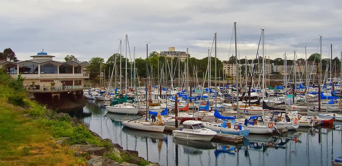
Oak Bay Marina. Photo: rpaterso / Wikimedia Commons, CC BY-SA 2.0
Turkey Head Beach
Fifteen easy metres to a swim beside the marina.
Distance: 15 m · Route: Easy · Swim: Recommended · Launch: Manageable · Amenities: Picnic table
Turkey Head has a short, easy route. The District marks it for swimming and says a hand launch is manageable. Watch for marina traffic, wind, kelp, and posted notices.
Radcliff Lane
Ten metres from the road to a recommended swim.
Distance: 10 m · Route: Easy · Swim: Recommended · Launch: Not recommended
The route is only ten metres from road to shore, and the District recommends it for swimming. It is a small access, so be considerate of neighbours and other visitors.
Mimicking Point at Radcliff Lane
The District names it, then leaves the rest blank.
Note: Distance and suitability are not listed in the District's 2025 table.
The District names Mimicking Point but gives no distance or use rating for it. Use Radcliff Lane as the documented access; there is no official recommendation for using Mimicking Point.
Kitty Islet
For sitting, looking and leaving the wildlife alone.
Distance: 20 m · Route: Moderate · Swim: Not recommended · Launch: Not recommended · Amenities: Picnic table
Kitty Islet is for looking, sitting, and noticing what the water is doing. It is also subject to federal migratory-bird rules, and dogs are prohibited on the islet.
South Oak Bay
The southern entries are where the distance column starts lying by omission. Some of the District's hardest routes sit surprisingly close to water it recommends for swimming. The climb, footing, and wet trip back up matter more than the number of metres.
McNeill Bay
Swim, launch or sit awhile. Just check which stairs are open.
Distance: 15 m · Route: Moderate · Swim: Recommended · Launch: Manageable
McNeill Bay is the clear multi-use choice on this part of the coast. There is a current access change nearby: the Monterey Avenue stairs are closed because of erosion around a storm outfall. The District says the beach remains accessible from Beach Drive at Oliver Street.
That closure is why this guide carries a checked date. A beach can be open while your usual staircase is not.
Sunny Lane
Twelve metres that earn the hardest rating.
Distance: 12 m · Route: Difficult · Swim: Not recommended · Launch: Not recommended
Short does not mean simple. Sunny Lane is only 12 metres from the closest road access and still receives the District's hardest access rating.
Lorne Terrace at Maquinna Street
Hard down, good for swimming, harder back up.
Distance: 45 m · Route: Difficult · Swim: Recommended · Launch: Not recommended
This may be the most surprising line in the table: difficult on the way down, green for swimming once you arrive. The climb back is part of the outing, especially with cold hands or wet gear.
Penzance Road
A shoreline reward for steady feet.
Distance: 75 m · Route: Difficult · Swim: Not recommended · Launch: Not recommended
Come for the shoreline, but only if you are steady on your feet and have no plans to get wet. Let the condition of the route, not the distance on the page, make the final call.
Repulse Street
Twenty metres that prove distance tells you very little.
Distance: 20 m · Route: Difficult · Swim: Not recommended · Launch: Not recommended
Repulse is another short route that earns the hardest access rating. It is a quick way to understand why distance alone tells you very little about a beach access.
Marne Street
The south-end sleeper, minus the amenities.
Distance: 20 m · Route: Moderate · Swim: Recommended · Launch: Manageable
Marne is one of the strongest lesser-known all-rounders on paper. It lacks the amenity icons of Willows and Cattle Point, so arrive ready to solve your own washroom, changing, and gear needs.
Foul Bay Road
A short final stop for swimmers and hand-carried boats.
Distance: 25 m · Route: Moderate · Swim: Recommended · Launch: Manageable
The final entry in the District table is another flexible one: a short route, a possible hand launch, and an official swim recommendation.
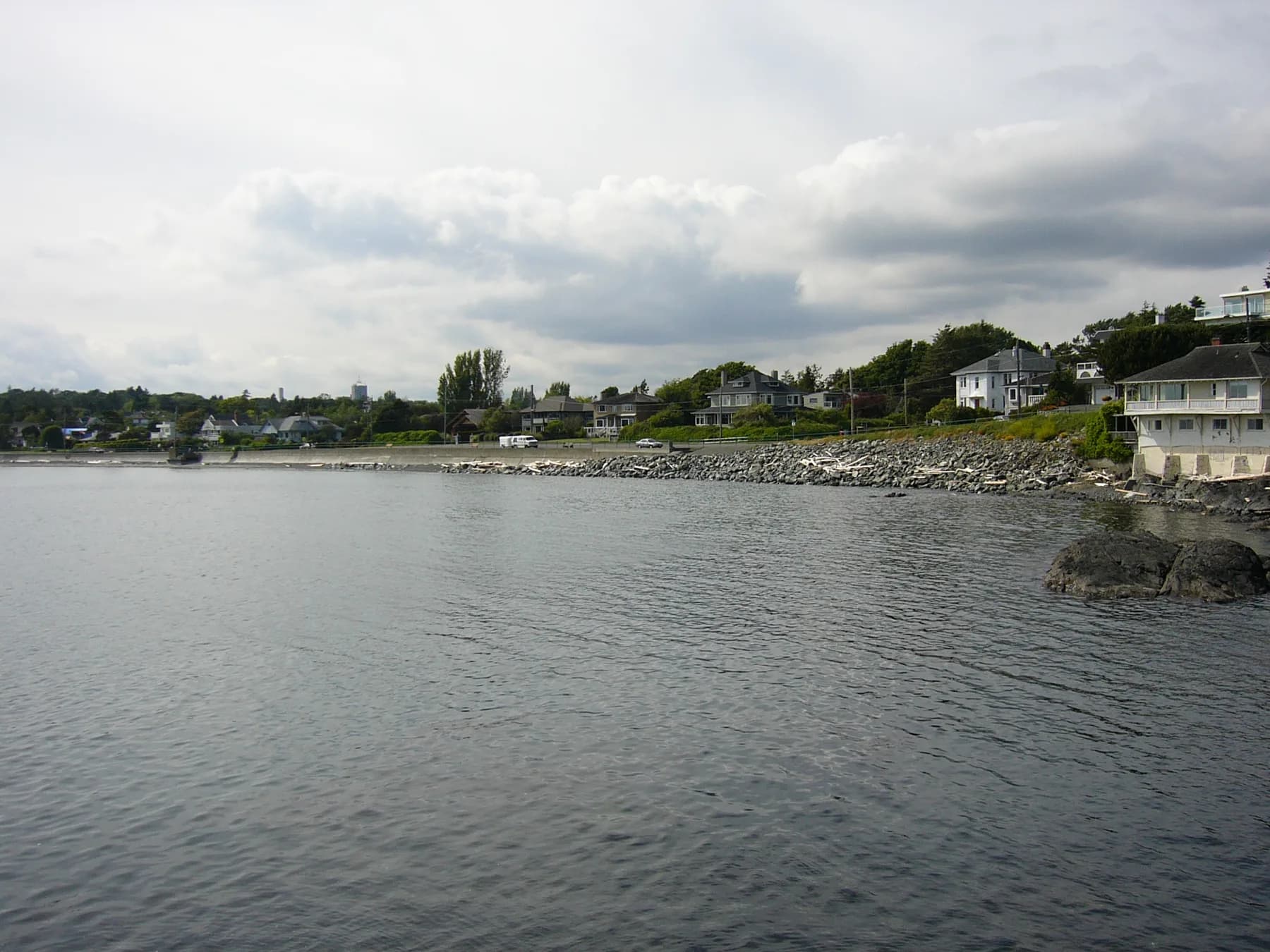
McNeill Bay esplanade. Photo: Agentn2o / Wikimedia Commons, CC BY-SA 3.0
All 23 accesses
Easy, moderate, and difficult are the District's route ratings. They are not formal accessibility certifications. Manageable means a hand launch may be possible, but the District stops short of recommending it.
Download the map. Get the next guide. Download the full phone-sized map below, with all 23 entries from north to south. No signup needed. Get future field guides in the Saturday email. Save the full beach access map
District of Oak Bay beach-access ratings, May 2025
| Public access | Distance | Route | Launch | Swim |
|---|---|---|---|---|
| Hibbins Close | 58 m | Moderate | No | Yes |
| Exeter Road | 34 m | Easy | Manageable | No |
| Humber Road | 7 m | Moderate | Manageable | No |
| Lansdowne Road | 93 m | Moderate | No | No |
| Rutland Road | 35 m | Moderate | No | No |
| Surrey Road | 80 m | Moderate | Manageable | No |
| Cattle Point | 125 m | Easy | Recommended | No |
| Willows at Estevan | 100 m | Easy | Recommended | Yes |
| Willows at Dalhousie | 115 m | Easy | Recommended | Yes |
| Willows at Bowker Avenue | 120 m | Easy | No | Yes |
| Bowker Lane | 195 m | Easy | No | No |
| Oak Bay Beach, 1400 block | 15 m | Easy | Manageable | No |
| Turkey Head Beach | 15 m | Easy | Manageable | Yes |
| Radcliff Lane | 10 m | Easy | No | Yes |
| Mimicking Point | Not listed | Not listed | Not listed | Not listed |
| Kitty Islet | 20 m | Moderate | No | No |
| McNeill Bay | 15 m | Moderate | Manageable | Yes |
| Sunny Lane | 12 m | Difficult | No | No |
| Lorne Terrace | 45 m | Difficult | No | Yes |
| Penzance Road | 75 m | Difficult | No | No |
| Repulse Street | 20 m | Difficult | No | No |
| Marne Street | 20 m | Moderate | Manageable | Yes |
| Foul Bay Road | 25 m | Moderate | Manageable | Yes |
Know one of the staircases we are missing? We found properly licensed photos for the best-known stops and several smaller road ends. We will not pass off a generic beach as Exeter, Humber, Lorne, or Repulse. Send us a clear photo and the access name, and we will build the complete 23-stop photo map with local eyes on it. Send a beach access photo
Going in fall
September does not close the coast. It changes the dress code. The water is colder, the weather changes faster, and fewer people may be around if you need help.
Check the tide and forecast before leaving. Bring warm layers and use proper cold-water gear if you plan to swim or paddle. Willows works well for a long walk, while Cattle Point is a good place to watch birds, explore at low tide, or sit by the water.
Fall makes the driftwood, kelp, storm light, and the differences between one bay and the next harder to miss.
Twenty-three ways down. This fall, follow one you have always passed.
- Check the Oak Bay tide before leaving home.
- If you plan to swim, check current water-quality information and obey posted notices.
- Treat a District swim rating as general guidance, not a live safety guarantee.
- Use proper thermal protection and visibility gear for cold-water swimming or paddling.
- Leave intertidal life where it is, give birds room, and bring back everything you carried down.
Questions people ask
How many public beach accesses are there in Oak Bay?
The District of Oak Bay's May 2025 Community Profile lists 23 public beach access points along nearly 18 kilometres of coastline.
Which Oak Bay beaches are recommended for swimming?
The District recommends swimming at Hibbins Close; Willows Beach through Estevan Avenue, Dalhousie Street, and Bowker Avenue; Turkey Head Beach; Radcliff Lane; McNeill Bay; Lorne Terrace; Marne Street; and Foul Bay Road. Conditions and closures can change, so check posted signs and current water information.
Where can I launch a kayak in Oak Bay?
The District recommends Cattle Point and the Estevan and Dalhousie entrances at Willows Beach for launching kayaks or canoes. Several other accesses are rated manageable rather than recommended.
Are dogs allowed at Willows Beach?
Dogs are prohibited on Willows Beach from May 1 through September 30. South Willows, from Bowker Avenue to the south boundary of Glenlyon Norfolk School, is dog-free year-round.
Is the Monterey Avenue access to McNeill Bay open?
As of September 20, 2026, the District says the Monterey Avenue beach access is closed because of erosion near a storm outfall. Beach access remains available from Beach Drive at Oliver Street. Check the District project page before visiting.
Sources and further reading
- District of Oak Bay, 2025 Community Profile, beach access table on page 29
- District of Oak Bay beach access map
- Canadian Hydrographic Service, Oak Bay station 07130
- Swim Guide, Willows Beach at Estevan
- Health Canada recreational-water hazards
- District of Oak Bay animal-control bylaw
- District of Oak Bay, McNeill Bay shoreline erosion
- University of Victoria, siʔčə́ŋəɬ
- Willows Beach photograph by Alanarce, CC BY-SA 4.0
- Additional Oak Bay access photographs and licence details
Know a staircase we should photograph—or one that has changed? Send the access name and a clear photo to info@oakbaylocal.com. We will keep this guide current. Get new Oak Bay field guides every Saturday